Navigating Ugandan Roads: GPS and Maps for Self-Drive Safaris
Navigating Ugandan Roads: GPS and Maps for Self-Drive Safaris. Embarking on a self-drive safari in Uganda is an adventure that promises unparalleled freedom, breathtaking landscapes, and intimate encounters with wildlife. However, navigating the roads of Uganda requires careful planning, reliable navigation tools, and a good understanding of the terrain. This comprehensive guide will help you prepare for a successful self-drive safari, focusing on the use of GPS and maps to navigate the diverse roads of Uganda.

Understanding the Terrain and Road Conditions
Before delving into navigation tools, it is essential to understand the nature of Ugandan roads. Uganda’s road network consists of paved highways, gravel roads, and dirt tracks, each presenting unique challenges:
- Paved Highways: These are found mainly between major cities and towns, such as the Entebbe-Kampala Highway and the Kampala-Masaka Road. They are generally in good condition but can be congested, especially near urban centers.
- Gravel Roads: These roads connect smaller towns and rural areas. They are passable but may have potholes and uneven surfaces.
- Dirt Tracks: Leading to national parks and remote villages, these tracks can become treacherous, especially during the rainy season when they can turn muddy and slippery.
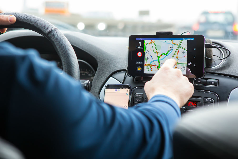
The Role of GPS in Navigation
Global Positioning System (GPS) devices are indispensable for modern navigation. In Uganda, GPS can significantly enhance your driving experience by providing real-time location data, turn-by-turn directions, and traffic updates.
- Choosing the Right GPS Device: Opt for a device with detailed maps of Uganda. Brands like Garmin offer robust models suitable for off-road and remote areas.
- Pre-Downloading Maps: Ensure your GPS device has the latest maps of Uganda. You can download maps from sources like OpenStreetMap or purchase detailed maps from Garmin.
- Using GPS for Route Planning: Input your destinations beforehand. For instance, if traveling from Kampala to Queen Elizabeth National Park, plan your route to avoid traffic and select the most scenic paths.
- Traffic Updates and Alternate Routes: Some GPS devices offer real-time traffic updates. In cities like Kampala, this feature is invaluable for avoiding traffic jams.
Leveraging Smartphone Apps for Navigation
In addition to dedicated GPS devices, smartphone apps offer versatile navigation solutions. Applications like Google Maps and Maps.me are popular choices:
- Google Maps: It provides comprehensive maps, real-time traffic updates, and points of interest. Before your trip, download offline maps of Uganda to ensure you remain navigationally equipped even in areas without internet coverage.
- Maps.me: This app is renowned for its offline capabilities and detailed maps, particularly useful in rural and remote regions. It includes hiking trails and lesser-known tracks often missed by other navigation tools.
Using Traditional Paper Maps
While digital navigation tools are immensely useful, traditional paper maps serve as an excellent backup and offer a broader overview of the terrain. Navigating Ugandan Roads: GPS and Maps for Self-Drive Safaris. They are especially useful in regions with poor GPS signals.
- Purchasing Quality Maps: Obtain detailed maps from reputable sources like the Uganda Wildlife Authority or travel bookstores. These maps often include topographical details and park information.
- Marking Key Locations: Before setting off, mark your key destinations, such as national parks, lodges, and fuel stations. Highlighting these spots can simplify navigation and help you stay on course.
- Reading and Interpreting Maps: Familiarize yourself with map symbols and scale. Understanding elevation changes and road types can prepare you for varying driving conditions.
Practical Tips for Navigating Ugandan Roads
To ensure a smooth and enjoyable self-drive safari, consider these additional tips:
- Vehicle Maintenance: Regularly check your vehicle’s condition, including tires, oil, and fuel levels. Carry spare tires and essential tools.
- Safety Precautions: Always lock your vehicle and avoid driving at night due to potential hazards and limited visibility.
- Local Assistance: In case of breakdowns or getting lost, don’t hesitate to ask locals for directions. Ugandans are generally friendly and willing to help.
- Emergency Contacts: Keep a list of emergency contacts, including your rental company, local police, and medical services.
Combining Navigation Tools for Optimal Results
While GPS devices and smartphone apps are highly reliable, combining them with traditional paper maps can enhance your navigation experience. Here’s how you can effectively use all three:
- Primary Navigation with GPS: Use your GPS device as the primary tool for real-time navigation. Its turn-by-turn directions and traffic updates will keep you on track.
- Supplementary Navigation with Smartphone Apps: Utilize apps like Google Maps and Maps.me to find points of interest, alternative routes, and offline navigation in remote areas.
- Backup with Paper Maps: Refer to paper maps for a broad overview of the region, to verify routes, and when digital tools fail due to signal loss or battery issues.

Managing Road Challenges
Navigating Ugandan roads comes with its own set of challenges. Here’s how to tackle some common issues:
- Potholes and Rough Roads: Drive slowly on gravel roads and dirt tracks to avoid damaging your vehicle. Keep an eye out for potholes and uneven surfaces.
- Weather Conditions: Be prepared for sudden weather changes. During the rainy season, dirt tracks can become muddy and slippery. A 4×4 vehicle is recommended for such conditions.
- Wildlife Encounters: When driving through national parks and wildlife reserves, be cautious of animals crossing the road. Maintain a safe distance and avoid honking.
- Navigational Errors: If you miss a turn or take a wrong path, stay calm and use your GPS to re-route. Sometimes, asking locals for the best way forward can be helpful.
Conclusion
Navigating the roads of Uganda on a self-drive safari is an exhilarating experience that offers a unique way to explore the country’s natural beauty and wildlife. With the right preparation, including reliable GPS devices, smartphone apps, and traditional maps, you can confidently traverse Uganda’s diverse landscapes. By planning your route carefully and taking necessary precautions, you ensure a safe and memorable safari adventure. Whether you are navigating the bustling streets of Kampala or the remote tracks of Bwindi, these tools and tips will guide you on an unforgettable journey through the Pearl of Africa.
Related Posts;